According to NHK, the earthquake's fracture zone may not have been a single spot, but along a line, 100km long, off the coast. USGS has kmz files to view worldwide earthquakes for the past 7 days; two days before the 8.9 (Richter scale) quake, just 43km away a 7.2 quake had occurred.
Photos appear to show the tsunami went at least 4.5km / 2 mi inland in Sendai. Much, much more photos available on MSNBC's slideshow.
| (via Kyodo via Reuters via MSNBC) |
[update 1]
NYT, along with other reporters, talked with USGS on the earthquake. AP's story says that according to the USGS, a section of the earth 15 miles (24km) below the ocean floor, the size of about 186 x 93 miles (300km x 150km) ruptured, and moved the main Japanese island of Honshu 8 feet (2.4m) west.
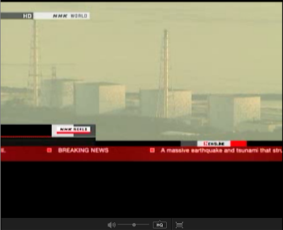
According to NHK, Fukushima #1 and #2 plants are expected to release air, but not before they evacuate residents within a 6 mile (10km) radius (expanded radius on orders by PM Kan). Both plants have reactors that are overheating, but they cannot get into one of them as the radiation is too high, and they are evaluating their options. Japan Times confirmed that radiation did leak from #1, as radiation was measured up to 8x the normal level at Fukushima #1 front gate.
Over 570 dead and another 700+ missing, according to NHK World.
At least one passenger ship with 100 people and a bullet train is missing -- as in, disappeared from the surface -- but Japan Today is reporting four bullet trains missing in the Miyagi and Iwate prefectures.


No comments:
Post a Comment